
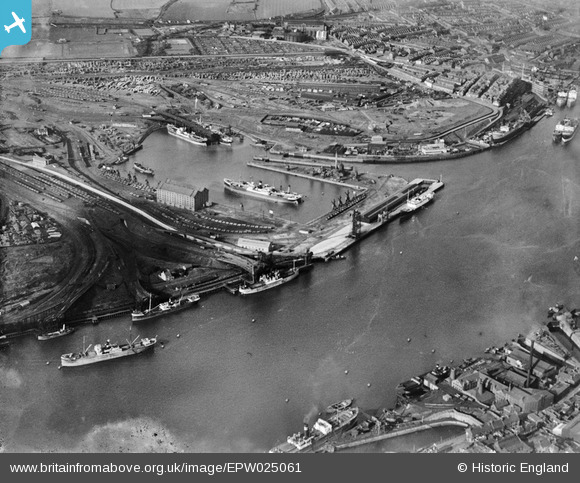
EPW025061 ENGLAND (1928). The Albert Edward Dock, Royal Quays, from the south-east, 1928
© Copyright OpenStreetMap contributors and licensed by the OpenStreetMap Foundation. 2026. Cartography is licensed as CC BY-SA.
Nearby Images (8)
EPW025061

EPW025062

EPW025068

EAW014536

EPW019845

EPW025066

EAW008941

EPW025067

Details
| Title | [EPW025061] The Albert Edward Dock, Royal Quays, from the south-east, 1928 |
| Reference | EPW025061 |
| Date | 14-October-1928 |
| Link | |
| Place name | ROYAL QUAYS |
| Parish | |
| District | |
| Country | ENGLAND |
| Easting / Northing | 435442, 566551 |
| Longitude / Latitude | -1.445997153581, 54.992208415312 |
| National Grid Reference | NZ354666 |
Pins
Be the first to add a comment to this image!