
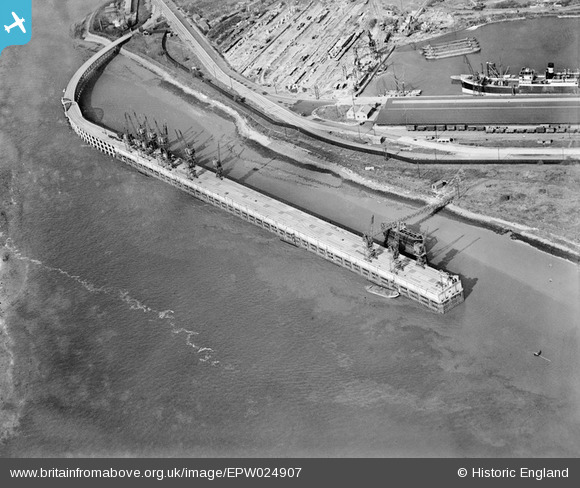
EPW024907 ENGLAND (1928). The docks and deep water jetty, Tilbury Ness, 1928
© Copyright OpenStreetMap contributors and licensed by the OpenStreetMap Foundation. 2026. Cartography is licensed as CC BY-SA.
Nearby Images (4)
EPW024907

EPW024909

EPW024908

EPW024906

Details
| Title | [EPW024907] The docks and deep water jetty, Tilbury Ness, 1928 |
| Reference | EPW024907 |
| Date | 3-October-1928 |
| Link | |
| Place name | TILBURY NESS |
| Parish | |
| District | |
| Country | ENGLAND |
| Easting / Northing | 563120, 175067 |
| Longitude / Latitude | 0.34783382909834, 51.450568527333 |
| National Grid Reference | TQ631751 |
Pins
Be the first to add a comment to this image!
User Comment Contributions
I'm fairly sure that the whole point of taking this photo was to capture the major and rare Civil Engineering event of new Locks being built. The new Locks were built to enable Tilbury to take the "Panamax" ships just coming into use. Panamax is the term used for the largest ships able to get through the Panama Canal (completed in 1914). The new Locks came into use in early 1929. Although the Lock Gates are not in this photo (see others), the deep water jetty would not have been built without them. |

BigglesH |
Wednesday 10th of April 2013 05:50:34 PM |