
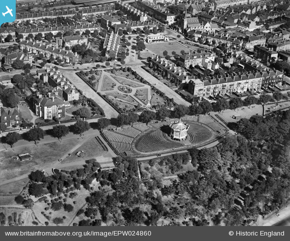
EPW024860 ENGLAND (1928). Prittlewell Square and the bandstand, Southend-on-Sea, 1928
© Copyright OpenStreetMap contributors and licensed by the OpenStreetMap Foundation. 2026. Cartography is licensed as CC BY-SA.
Nearby Images (16)
EPW024860

EPW040986

EPW058501

EAW002208

EPW024868

EAW002207

EPW000555

EPW037017

EPW036734

EPW036724

EPW054675

EPW036998

EPW036712

EPW037008

EPW024879

EPW000564

Details
| Title | [EPW024860] Prittlewell Square and the bandstand, Southend-on-Sea, 1928 |
| Reference | EPW024860 |
| Date | 3-October-1928 |
| Link | |
| Place name | SOUTHEND-ON-SEA |
| Parish | |
| District | |
| Country | ENGLAND |
| Easting / Northing | 587919, 185196 |
| Longitude / Latitude | 0.70976584407417, 51.533865510966 |
| National Grid Reference | TQ879852 |
Pins
Be the first to add a comment to this image!