
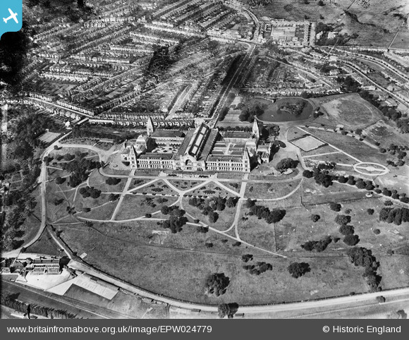
EPW024779 ENGLAND (1928). Alexandra Palace, Muswell Hill, 1928
© Copyright OpenStreetMap contributors and licensed by the OpenStreetMap Foundation. 2026. Cartography is licensed as CC BY-SA.
Nearby Images (21)
EPW024779

EPW024778

EPW046814

EPW005787

EPW005590

EPW024780

EAW022329

EPW005788

EPW046818

EPW008882

EPW046809

EPW060956

EAW015854

EPW026945

EAW003047

EAW022328

EPW005789

EPW046812

EPW046811

EPW006283

EPW026944

Details
| Title | [EPW024779] Alexandra Palace, Muswell Hill, 1928 |
| Reference | EPW024779 |
| Date | September-1928 |
| Link | |
| Place name | MUSWELL HILL |
| Parish | |
| District | |
| Country | ENGLAND |
| Easting / Northing | 529634, 190011 |
| Longitude / Latitude | -0.12832897632824, 51.593539380446 |
| National Grid Reference | TQ296900 |
Pins

Alan McFaden |
Wednesday 17th of July 2013 11:05:23 AM |
