
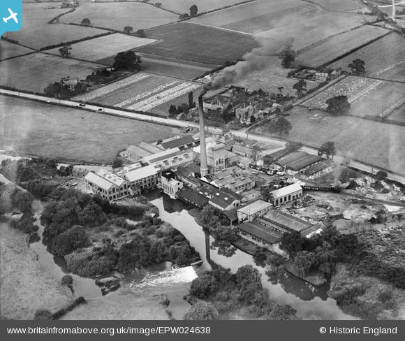
EPW024638 ENGLAND (1928). Alders Paper Mill, Tamworth, 1928
© Copyright OpenStreetMap contributors and licensed by the OpenStreetMap Foundation. 2026. Cartography is licensed as CC BY-SA.
Details
| Title | [EPW024638] Alders Paper Mill, Tamworth, 1928 |
| Reference | EPW024638 |
| Date | September-1928 |
| Link | |
| Place name | TAMWORTH |
| Parish | |
| District | |
| Country | ENGLAND |
| Easting / Northing | 419111, 304544 |
| Longitude / Latitude | -1.717559506326, 52.63795486547 |
| National Grid Reference | SK191045 |
Pins

Andrew Sandars |
Tuesday 20th of January 2015 07:15:37 PM | |
|
Andrew Sandars |
Tuesday 20th of January 2015 07:11:34 PM | |
|
Andrew Sandars |
Tuesday 20th of January 2015 07:10:44 PM | |
|
John Wass |
Saturday 10th of January 2015 09:13:23 PM |

User Comment Contributions

Established about 1820, Owned by Marsden (Chas.) & Sons; Charles Briggs; Alliance Alders; Smurfits. Shut 1993 |
Chris |
Saturday 30th of July 2016 11:08:22 AM |