
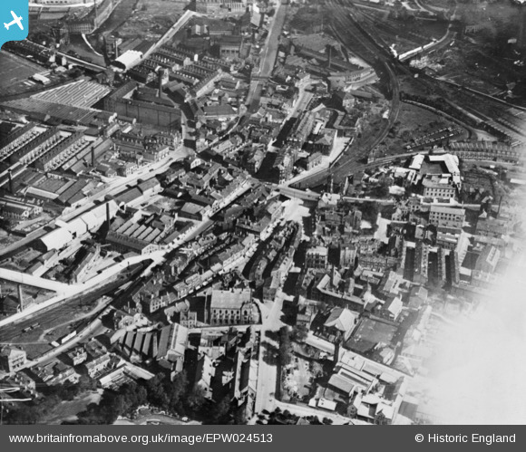
EPW024513 ENGLAND (1928). The town centre, Shipley, 1928. This image has been produced from a copy-negative.
© Copyright OpenStreetMap contributors and licensed by the OpenStreetMap Foundation. 2025. Cartography is licensed as CC BY-SA.
Nearby Images (2)
EPW024513

EPW024519

Details
| Title | [EPW024513] The town centre, Shipley, 1928. This image has been produced from a copy-negative. |
| Reference | EPW024513 |
| Date | September-1928 |
| Link | |
| Place name | SHIPLEY |
| Parish | |
| District | |
| Country | ENGLAND |
| Easting / Northing | 414775, 437604 |
| Longitude / Latitude | -1.7754669316162, 53.83427222712 |
| National Grid Reference | SE148376 |
Pins
 michael |
Monday 16th of January 2017 08:12:55 PM | |
John W |
Monday 8th of August 2016 03:16:26 PM | |
John W |
Monday 8th of August 2016 03:14:38 PM | |
H.J.Hill |
Wednesday 4th of March 2015 10:17:17 AM | |
H.J.Hill |
Thursday 13th of November 2014 04:56:41 PM |