
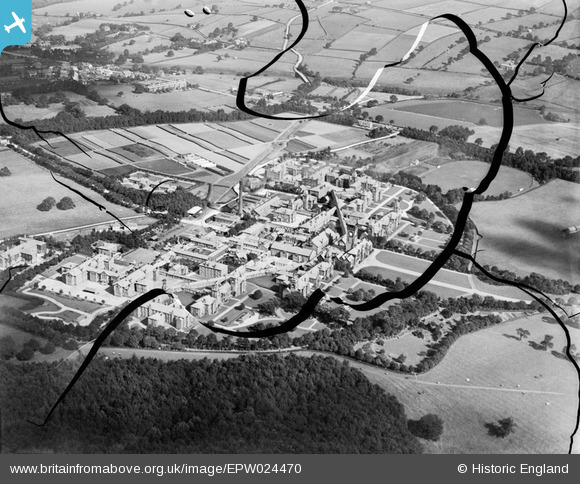
EPW024470 ENGLAND (1928). Menston Mental Hospital, Guiseley, 1928. This image has been produced from a damaged negative.
© Copyright OpenStreetMap contributors and licensed by the OpenStreetMap Foundation. 2026. Cartography is licensed as CC BY-SA.
Nearby Images (2)
EPW024470

EPW024469

Details
| Title | [EPW024470] Menston Mental Hospital, Guiseley, 1928. This image has been produced from a damaged negative. |
| Reference | EPW024470 |
| Date | September-1928 |
| Link | |
| Place name | GUISELEY |
| Parish | |
| District | |
| Country | ENGLAND |
| Easting / Northing | 417481, 442963 |
| Longitude / Latitude | -1.7340394927244, 53.882359342209 |
| National Grid Reference | SE175430 |
Pins

Vin Albo |
Tuesday 23rd of February 2021 05:45:43 AM |
