
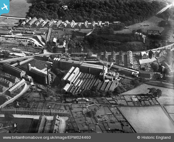
EPW024460 ENGLAND (1928). Robert Clough Grove Worsted Mills and environs, Ingrow, 1928
© Copyright OpenStreetMap contributors and licensed by the OpenStreetMap Foundation. 2026. Cartography is licensed as CC BY-SA.
Nearby Images (3)
EPW024460

EPW024457

EPW024459

Details
| Title | [EPW024460] Robert Clough Grove Worsted Mills and environs, Ingrow, 1928 |
| Reference | EPW024460 |
| Date | September-1928 |
| Link | |
| Place name | INGROW |
| Parish | KEIGHLEY |
| District | |
| Country | ENGLAND |
| Easting / Northing | 405470, 439614 |
| Longitude / Latitude | -1.9168372743572, 53.852521282227 |
| National Grid Reference | SE055396 |
Pins

J May |
Wednesday 11th of July 2018 07:33:29 PM |
