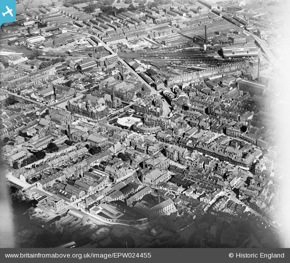
EPW024455 ENGLAND (1928). The town centre, Keighley, 1928
© Copyright OpenStreetMap contributors and licensed by the OpenStreetMap Foundation. 2025. Cartography is licensed as CC BY-SA.
Details
| Title | [EPW024455] The town centre, Keighley, 1928 |
| Reference | EPW024455 |
| Date | September-1928 |
| Link | |
| Place name | KEIGHLEY |
| Parish | KEIGHLEY |
| District | |
| Country | ENGLAND |
| Easting / Northing | 406075, 441272 |
| Longitude / Latitude | -1.9076063888881, 53.867418165605 |
| National Grid Reference | SE061413 |


![[EPW024455] The town centre, Keighley, 1928](http://britainfromabove.org.uk/sites/all/libraries/aerofilms-images/public/100x100/EPW/024/EPW024455.jpg)
![[EPW024373] The town hall and Mechanics Institute, Keighley, 1928](http://britainfromabove.org.uk/sites/all/libraries/aerofilms-images/public/100x100/EPW/024/EPW024373.jpg)
![[EPW024456] The town hall and Mechanics Institute, Keighley, 1928](http://britainfromabove.org.uk/sites/all/libraries/aerofilms-images/public/100x100/EPW/024/EPW024456.jpg)
![[EPW024458] North Street and environs, Keighley, 1928](http://britainfromabove.org.uk/sites/all/libraries/aerofilms-images/public/100x100/EPW/024/EPW024458.jpg)
