
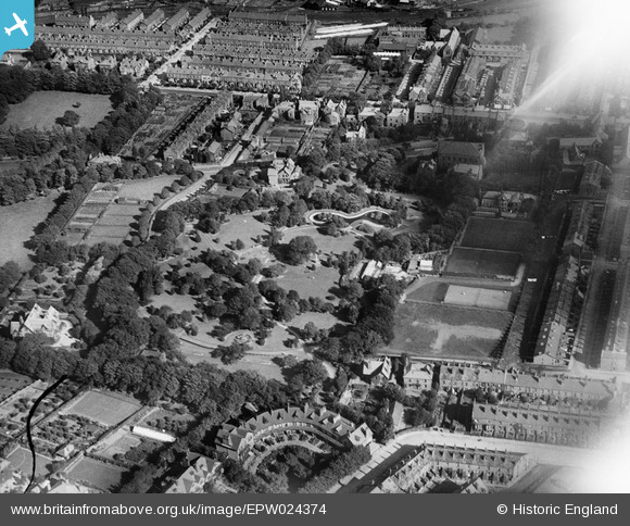
EPW024374 ENGLAND (1928). Devonshire Park, Keighley, 1928
© Copyright OpenStreetMap contributors and licensed by the OpenStreetMap Foundation. 2024. Cartography is licensed as CC BY-SA.
Nearby Images (3)
EPW024374

EPW024375

EPW024458

Details
| Title | [EPW024374] Devonshire Park, Keighley, 1928 |
| Reference | EPW024374 |
| Date | September-1928 |
| Link | |
| Place name | KEIGHLEY |
| Parish | KEIGHLEY |
| District | |
| Country | ENGLAND |
| Easting / Northing | 405810, 441709 |
| Longitude / Latitude | -1.9116284425909, 53.871349347497 |
| National Grid Reference | SE058417 |
Pins
Be the first to add a comment to this image!