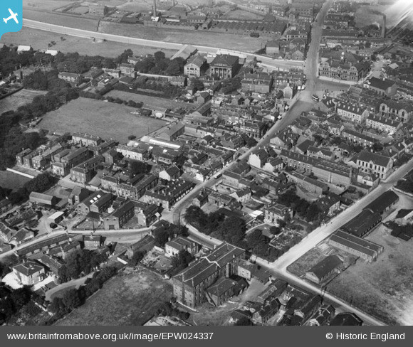
EPW024337 ENGLAND (1928). The town centre, Ossett, 1928
© Copyright OpenStreetMap contributors and licensed by the OpenStreetMap Foundation. 2024. Cartography is licensed as CC BY-SA.
Details
| Title | [EPW024337] The town centre, Ossett, 1928 |
| Reference | EPW024337 |
| Date | September-1928 |
| Link | |
| Place name | OSSETT |
| Parish | |
| District | |
| Country | ENGLAND |
| Easting / Northing | 427750, 420300 |
| Longitude / Latitude | -1.5798478359502, 53.67819844977 |
| National Grid Reference | SE278203 |
Pins
 Ossett Tyre House |
Wednesday 15th of April 2015 11:06:26 AM | |
 danr_uk |
Sunday 26th of August 2012 08:18:24 PM | |
Now burnt down. |
 Brick Collector |
Monday 19th of January 2015 08:18:02 PM |


![[EPW024337] The town centre, Ossett, 1928](http://britainfromabove.org.uk/sites/all/libraries/aerofilms-images/public/100x100/EPW/024/EPW024337.jpg)
![[EPW024330] The town centre, Ossett, 1928](http://britainfromabove.org.uk/sites/all/libraries/aerofilms-images/public/100x100/EPW/024/EPW024330.jpg)
![[EPW024331] The Town Hall and surroundings, Ossett, 1928](http://britainfromabove.org.uk/sites/all/libraries/aerofilms-images/public/100x100/EPW/024/EPW024331.jpg)
![[EPW024339] The town centre, Ossett, 1928](http://britainfromabove.org.uk/sites/all/libraries/aerofilms-images/public/100x100/EPW/024/EPW024339.jpg)