
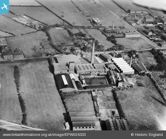
EPW024333 ENGLAND (1928). Highfield Woollen and Worsted Mill, Ossett, 1928
© Copyright OpenStreetMap contributors and licensed by the OpenStreetMap Foundation. 2024. Cartography is licensed as CC BY-SA.
Nearby Images (3)
EPW024333

EPW024336

EPW024334

Details
| Title | [EPW024333] Highfield Woollen and Worsted Mill, Ossett, 1928 |
| Reference | EPW024333 |
| Date | September-1928 |
| Link | |
| Place name | OSSETT |
| Parish | |
| District | |
| Country | ENGLAND |
| Easting / Northing | 427677, 421336 |
| Longitude / Latitude | -1.5808606125313, 53.687514869255 |
| National Grid Reference | SE277213 |
Pins
Be the first to add a comment to this image!