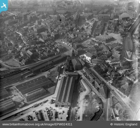
EPW024311 ENGLAND (1928). The town centre, Dewsbury, 1928
© Copyright OpenStreetMap contributors and licensed by the OpenStreetMap Foundation. 2026. Cartography is licensed as CC BY-SA.
Details
| Title | [EPW024311] The town centre, Dewsbury, 1928 |
| Reference | EPW024311 |
| Date | September-1928 |
| Link | |
| Place name | DEWSBURY |
| Parish | |
| District | |
| Country | ENGLAND |
| Easting / Northing | 424737, 421728 |
| Longitude / Latitude | -1.6253514668542, 53.691186062503 |
| National Grid Reference | SE247217 |
Pins

Michael |
Friday 25th of October 2019 03:19:31 PM | |

Michael |
Friday 25th of October 2019 03:17:33 PM | |

Graham Cass |
Sunday 17th of September 2017 04:11:09 PM | |

gBr |
Thursday 4th of May 2017 01:40:26 PM | |

gBr |
Thursday 4th of May 2017 01:38:44 PM | |

HOLMES |
Thursday 16th of March 2017 06:56:30 PM | |

Amaan |
Tuesday 31st of January 2017 12:11:36 AM | |

Philip |
Friday 23rd of January 2015 12:24:55 AM | |

Philip |
Friday 23rd of January 2015 12:21:53 AM | |

Philip |
Friday 23rd of January 2015 12:19:56 AM |


![[EPW024311] The town centre, Dewsbury, 1928](http://britainfromabove.org.uk/sites/all/libraries/aerofilms-images/public/100x100/EPW/024/EPW024311.jpg)
![[EPW024312] The town centre, Dewsbury, 1928](http://britainfromabove.org.uk/sites/all/libraries/aerofilms-images/public/100x100/EPW/024/EPW024312.jpg)
![[EPW024315] The town centre, Dewsbury, 1928](http://britainfromabove.org.uk/sites/all/libraries/aerofilms-images/public/100x100/EPW/024/EPW024315.jpg)