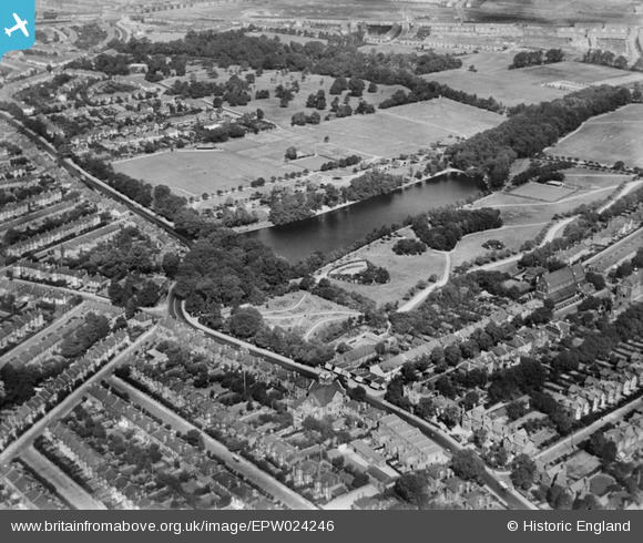
EPW024246 ENGLAND (1928). Valentines Park, Ilford, 1928
© Copyright OpenStreetMap contributors and licensed by the OpenStreetMap Foundation. 2026. Cartography is licensed as CC BY-SA.
Details
| Title | [EPW024246] Valentines Park, Ilford, 1928 |
| Reference | EPW024246 |
| Date | September-1928 |
| Link | |
| Place name | ILFORD |
| Parish | |
| District | |
| Country | ENGLAND |
| Easting / Northing | 543395, 187224 |
| Longitude / Latitude | 0.069082958659701, 51.565159016946 |
| National Grid Reference | TQ434872 |
Pins

mardell8 |
Thursday 27th of February 2014 12:14:22 PM | |

Chelmerfella |
Tuesday 17th of December 2013 05:01:13 PM | |

Chelmerfella |
Tuesday 17th of December 2013 04:59:26 PM |


![[EPW024246] Valentines Park, Ilford, 1928](http://britainfromabove.org.uk/sites/all/libraries/aerofilms-images/public/100x100/EPW/024/EPW024246.jpg)
![[EPW001388] Valentines Park, Ilford, 1920. This image has been produced from a copy-negative.](http://britainfromabove.org.uk/sites/all/libraries/aerofilms-images/public/100x100/EPW/001/EPW001388.jpg)
![[EPW058729] The Lake in Valentine's Park, Illford, 1938. This image has been produced from a copy-negative.](http://britainfromabove.org.uk/sites/all/libraries/aerofilms-images/public/100x100/EPW/058/EPW058729.jpg)
![[EPW024244] Valentines Park, Ilford, 1928](http://britainfromabove.org.uk/sites/all/libraries/aerofilms-images/public/100x100/EPW/024/EPW024244.jpg)
