
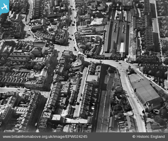
EPW024245 ENGLAND (1928). Ilford railway station and environs, Ilford, 1928
© Copyright OpenStreetMap contributors and licensed by the OpenStreetMap Foundation. 2026. Cartography is licensed as CC BY-SA.
Nearby Images (8)
EPW024245

EPW043393

EPW024242

EPW043394

EPW043396

EPW043397

EPW043395

EPW018654

Details
| Title | [EPW024245] Ilford railway station and environs, Ilford, 1928 |
| Reference | EPW024245 |
| Date | October-1928 |
| Link | |
| Place name | ILFORD |
| Parish | |
| District | |
| Country | ENGLAND |
| Easting / Northing | 543627, 186470 |
| Longitude / Latitude | 0.072120079645421, 51.558324127789 |
| National Grid Reference | TQ436865 |
Pins

pl8man |
Saturday 10th of February 2024 12:38:51 PM | |
|
pl8man |
Saturday 10th of February 2024 12:35:51 PM | |
|
John Wass |
Tuesday 24th of January 2017 03:31:26 PM | |
|
Hermann the German |
Saturday 12th of October 2013 04:01:47 PM | |
|
Hermann the German |
Saturday 12th of October 2013 03:58:44 PM | |
|
Hermann the German |
Saturday 12th of October 2013 03:47:36 PM |


User Comment Contributions
The roads look empty and spacious, unlike today, I can figure out a number of streets and roads, I used to live at 2 Northbrook Rd which is just out of the picture and is very close to the side entrance of Ilford station which has now been closed down. |

alfa57 |
Tuesday 26th of June 2012 10:57:43 AM |