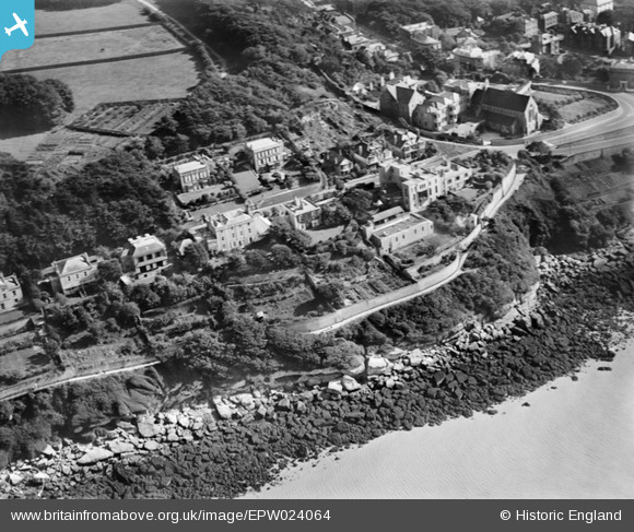
EPW024064 ENGLAND (1928). Lovers' Walk on High Cliff, Clevedon, 1928
© Copyright OpenStreetMap contributors and licensed by the OpenStreetMap Foundation. 2025. Cartography is licensed as CC BY-SA.
Nearby Images (5)
Details
| Title | [EPW024064] Lovers' Walk on High Cliff, Clevedon, 1928 |
| Reference | EPW024064 |
| Date | September-1928 |
| Link | |
| Place name | CLEVEDON |
| Parish | CLEVEDON |
| District | |
| Country | ENGLAND |
| Easting / Northing | 340368, 172192 |
| Longitude / Latitude | -2.8581516777649, 51.445084767164 |
| National Grid Reference | ST404722 |


![[EPW024064] Lovers' Walk on High Cliff, Clevedon, 1928](http://britainfromabove.org.uk/sites/all/libraries/aerofilms-images/public/100x100/EPW/024/EPW024064.jpg)
![[EPW024069] The Marine Hotel and private houses on High Cliff, Clevedon, 1928](http://britainfromabove.org.uk/sites/all/libraries/aerofilms-images/public/100x100/EPW/024/EPW024069.jpg)
![[EPW024061] The Catholic Church of the Immaculate Conception, Clevedon, 1928](http://britainfromabove.org.uk/sites/all/libraries/aerofilms-images/public/100x100/EPW/024/EPW024061.jpg)
![[EPW048464] High Cliff, Clevedon, 1935. This image has been produced from a copy-negative.](http://britainfromabove.org.uk/sites/all/libraries/aerofilms-images/public/100x100/EPW/048/EPW048464.jpg)
![[EPW024063] Marine Parade and environs, Clevedon, 1928](http://britainfromabove.org.uk/sites/all/libraries/aerofilms-images/public/100x100/EPW/024/EPW024063.jpg)
