
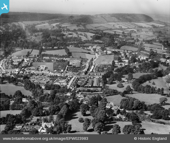
EPW023983 ENGLAND (1928). The cemetery and environs, Sidmouth, from the east, 1928
© Copyright OpenStreetMap contributors and licensed by the OpenStreetMap Foundation. 2026. Cartography is licensed as CC BY-SA.
Details
| Title | [EPW023983] The cemetery and environs, Sidmouth, from the east, 1928 |
| Reference | EPW023983 |
| Date | September-1928 |
| Link | |
| Place name | SIDMOUTH |
| Parish | SIDMOUTH |
| District | |
| Country | ENGLAND |
| Easting / Northing | 312948, 88520 |
| Longitude / Latitude | -3.2325168795541, 50.689233203007 |
| National Grid Reference | SY129885 |
Pins

SVA History Group |
Friday 20th of May 2016 10:00:48 AM | |
|
JM@Home |
Saturday 18th of October 2014 08:57:54 PM | |

Maurice |
Sunday 26th of August 2012 07:42:39 AM | |
|
Maurice |
Sunday 26th of August 2012 07:33:11 AM | |
Sidmouth Station was opened in 1874, and closed in 1967. See http://www.disused-stations.org.uk/s/sidmouth/index.shtml for more information about the station and photos of it before and after closure. (This site points out that to get nearer the town centre a fairly steep gradient would have needed - it may have been this practical consideration that kept the railway where it was.) |
John W |
Sunday 11th of September 2016 08:56:18 PM |
User Comment Contributions
Also shows the station and line from Tipton St John. |
Maurice |
Sunday 26th of August 2012 07:44:34 AM |