
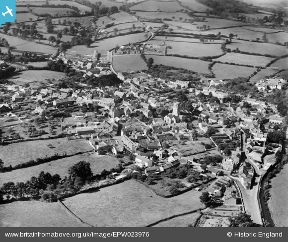
EPW023976 ENGLAND (1928). St Andrew's Church and the town, Colyton, 1928
© Copyright OpenStreetMap contributors and licensed by the OpenStreetMap Foundation. 2026. Cartography is licensed as CC BY-SA.
Nearby Images (2)
EPW023976

EPW023977

Details
| Title | [EPW023976] St Andrew's Church and the town, Colyton, 1928 |
| Reference | EPW023976 |
| Date | September-1928 |
| Link | |
| Place name | COLYTON |
| Parish | COLYTON |
| District | |
| Country | ENGLAND |
| Easting / Northing | 324610, 94057 |
| Longitude / Latitude | -3.068566180027, 50.74065144582 |
| National Grid Reference | SY246941 |
Pins

Kate Burhouse |
Saturday 8th of March 2025 08:11:04 PM | |
|
Kentishman |
Wednesday 11th of April 2018 03:01:29 PM | |
|
Kentishman |
Wednesday 14th of March 2018 03:55:53 PM | |
|
Kentishman |
Wednesday 14th of March 2018 03:50:40 PM |