
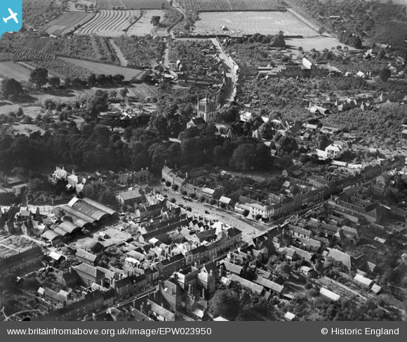
EPW023950 ENGLAND (1928). Broad Street and environs, Pershore, 1928
© Copyright OpenStreetMap contributors and licensed by the OpenStreetMap Foundation. 2026. Cartography is licensed as CC BY-SA.
Nearby Images (4)
EPW023950

EPW023949

EPW023951

EPW033939

Details
| Title | [EPW023950] Broad Street and environs, Pershore, 1928 |
| Reference | EPW023950 |
| Date | September-1928 |
| Link | |
| Place name | PERSHORE |
| Parish | PERSHORE |
| District | |
| Country | ENGLAND |
| Easting / Northing | 394853, 245758 |
| Longitude / Latitude | -2.0751650163864, 52.109712634979 |
| National Grid Reference | SO949458 |
Pins
Be the first to add a comment to this image!