
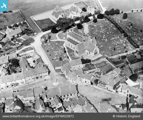
EPW023871 ENGLAND (1928). Holy Trinity Church, Minchinhampton, 1928
© Copyright OpenStreetMap contributors and licensed by the OpenStreetMap Foundation. 2026. Cartography is licensed as CC BY-SA.
Nearby Images (3)
EPW023871

EPW023872

EPW023873

Details
| Title | [EPW023871] Holy Trinity Church, Minchinhampton, 1928 |
| Reference | EPW023871 |
| Date | September-1928 |
| Link | |
| Place name | MINCHINHAMPTON |
| Parish | MINCHINHAMPTON |
| District | |
| Country | ENGLAND |
| Easting / Northing | 387227, 200794 |
| Longitude / Latitude | -2.1848646543687, 51.705280185732 |
| National Grid Reference | SO872008 |
Pins

Class31 |
Wednesday 12th of June 2013 12:35:59 PM | |
|
Class31 |
Saturday 20th of October 2012 09:37:53 PM | |
|
Class31 |
Tuesday 16th of October 2012 11:15:22 PM | |
|
Class31 |
Tuesday 16th of October 2012 11:09:42 PM | |
|
Class31 |
Tuesday 16th of October 2012 11:08:55 PM | |
|
Class31 |
Tuesday 16th of October 2012 11:05:40 PM | |
|
Class31 |
Tuesday 16th of October 2012 11:05:17 PM | |
|
Class31 |
Tuesday 16th of October 2012 11:02:43 PM | |
|
Class31 |
Tuesday 16th of October 2012 11:02:20 PM | |
|
Class31 |
Tuesday 16th of October 2012 10:58:43 PM | |
|
Class31 |
Tuesday 16th of October 2012 10:56:36 PM | |
|
Class31 |
Tuesday 16th of October 2012 10:54:15 PM |

User Comment Contributions
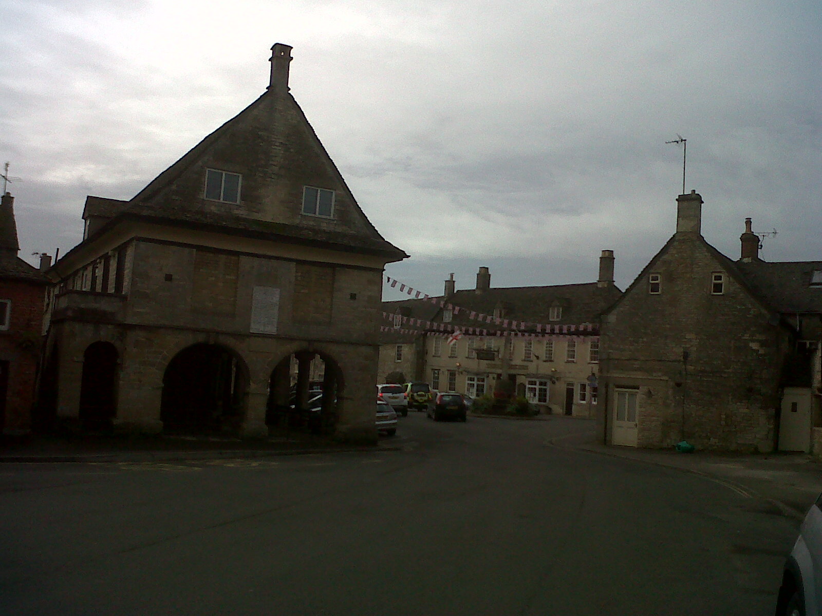
Market Square |
Class31 |
Thursday 4th of July 2013 12:47:04 PM |
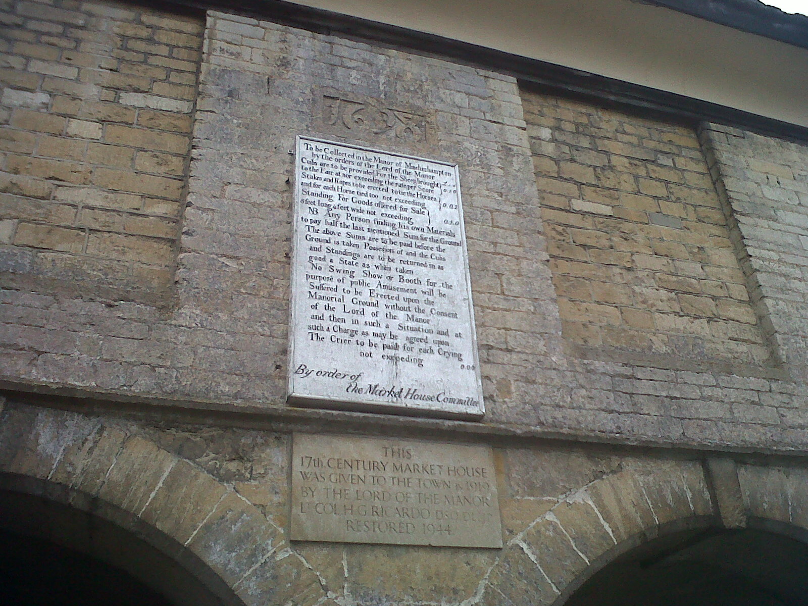
Notice on the end of the Market House and build date 1698 |
Class31 |
Thursday 4th of July 2013 12:44:38 PM |
Before 1863 Holy Trinity had a full spire. It was taken down on safety grounds and only the stub remains. The transepts and crossing - ie a cruciform footprint - suggest a 'mother' church, of earlier foundation than its neighbours, perhaps |

MB |
Wednesday 17th of October 2012 08:31:46 AM |