
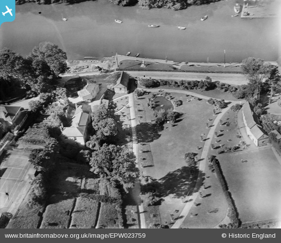
EPW023759 ENGLAND (1928). Saltmill Quay, Kingsbridge, 1928
© Copyright OpenStreetMap contributors and licensed by the OpenStreetMap Foundation. 2025. Cartography is licensed as CC BY-SA.
Nearby Images (2)
EPW023759

EPW023749

Details
| Title | [EPW023759] Saltmill Quay, Kingsbridge, 1928 |
| Reference | EPW023759 |
| Date | October-1928 |
| Link | |
| Place name | KINGSBRIDGE |
| Parish | KINGSBRIDGE |
| District | |
| Country | ENGLAND |
| Easting / Northing | 273691, 43824 |
| Longitude / Latitude | -3.7729881294358, 50.28022844466 |
| National Grid Reference | SX737438 |
Pins

MB |
Thursday 8th of November 2012 10:54:50 PM | |
I understand from another website that this is the town's War Memorial. |
John W |
Friday 26th of August 2016 09:00:22 PM |
|
MB |
Thursday 8th of November 2012 10:54:06 PM | |
|
MB |
Thursday 8th of November 2012 10:53:26 PM | |
|
MB |
Thursday 8th of November 2012 10:52:11 PM |