
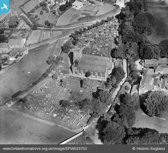
EPW023753 ENGLAND (1928). St Thomas a Becket's Church, Kingsbridge, 1928
© Copyright OpenStreetMap contributors and licensed by the OpenStreetMap Foundation. 2025. Cartography is licensed as CC BY-SA.
Nearby Images (3)
EPW023753

EPW023755

EPW023752

Details
| Title | [EPW023753] St Thomas a Becket's Church, Kingsbridge, 1928 |
| Reference | EPW023753 |
| Date | September-1928 |
| Link | |
| Place name | KINGSBRIDGE |
| Parish | KINGSBRIDGE |
| District | |
| Country | ENGLAND |
| Easting / Northing | 273931, 44507 |
| Longitude / Latitude | -3.7698487357012, 50.286419999167 |
| National Grid Reference | SX739445 |
Pins
Be the first to add a comment to this image!