
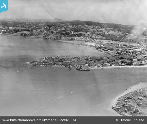
EPW023674 ENGLAND (1928). The Point, Exmouth, from the south-west, 1928.
© Copyright OpenStreetMap contributors and licensed by the OpenStreetMap Foundation. 2026. Cartography is licensed as CC BY-SA.
Nearby Images (8)
EPW023674

EPW033467

EPW023675

EPW023676

EAW007590

EPW033462

EAW051152

EAW051153

Details
| Title | [EPW023674] The Point, Exmouth, from the south-west, 1928. |
| Reference | EPW023674 |
| Date | September-1928 |
| Link | |
| Place name | EXMOUTH |
| Parish | EXMOUTH |
| District | |
| Country | ENGLAND |
| Easting / Northing | 299259, 80522 |
| Longitude / Latitude | -3.4240953572389, 50.615112986793 |
| National Grid Reference | SX993805 |
Pins
Allen T |
Wednesday 3rd of October 2012 12:01:50 AM |