
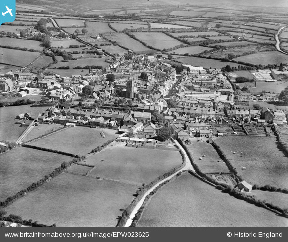
EPW023625 ENGLAND (1928). The town, Callington, from the west, 1928
© Copyright OpenStreetMap contributors and licensed by the OpenStreetMap Foundation. 2026. Cartography is licensed as CC BY-SA.
Nearby Images (6)
EPW023625

EPW023627

EPW023622

EPW023628

EPW023623

EPW023624

Details
| Title | [EPW023625] The town, Callington, from the west, 1928 |
| Reference | EPW023625 |
| Date | September-1928 |
| Link | |
| Place name | CALLINGTON |
| Parish | CALLINGTON |
| District | |
| Country | ENGLAND |
| Easting / Northing | 235642, 69675 |
| Longitude / Latitude | -4.3179757817796, 50.503179534344 |
| National Grid Reference | SX356697 |
Pins

MB |
Saturday 3rd of November 2012 04:39:37 PM | |
|
MB |
Saturday 3rd of November 2012 04:39:11 PM | |
|
MB |
Saturday 3rd of November 2012 03:53:21 PM | |
|
MB |
Saturday 3rd of November 2012 03:51:49 PM | |
|
MB |
Saturday 3rd of November 2012 03:48:44 PM | |
|
MB |
Saturday 3rd of November 2012 03:44:17 PM | |
|
MB |
Saturday 3rd of November 2012 03:43:17 PM | |
|
MB |
Saturday 3rd of November 2012 03:42:05 PM | |
|
MB |
Saturday 3rd of November 2012 03:41:14 PM | |
|
MB |
Saturday 3rd of November 2012 03:40:43 PM | |
|
MB |
Saturday 3rd of November 2012 03:40:14 PM | |
|
MB |
Saturday 3rd of November 2012 03:39:47 PM |