
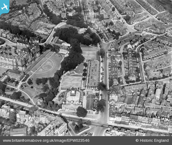
EPW023546 ENGLAND (1928). The Royal Hall, King's Road and environs, Harrogate, 1928
© Copyright OpenStreetMap contributors and licensed by the OpenStreetMap Foundation. 2026. Cartography is licensed as CC BY-SA.
Nearby Images (12)
EPW023546

EPW023545

EPW023544

EPW023542

EPW023543

EPW006595

EPW016247

EPW006599

EPW016248

EAW025652

EPW043183

EAW025648

Details
| Title | [EPW023546] The Royal Hall, King's Road and environs, Harrogate, 1928 |
| Reference | EPW023546 |
| Date | September-1928 |
| Link | |
| Place name | HARROGATE |
| Parish | |
| District | |
| Country | ENGLAND |
| Easting / Northing | 430085, 455658 |
| Longitude / Latitude | -1.5410335769104, 53.995890547089 |
| National Grid Reference | SE301557 |
Pins

aoxomoxoa |
Saturday 4th of October 2014 10:48:00 AM | |
Lynda Tubbs |
Wednesday 5th of March 2014 10:10:05 AM | |

Class31 |
Saturday 7th of July 2012 09:07:15 PM | |
|
Class31 |
Saturday 7th of July 2012 09:06:24 PM | |
|
Class31 |
Saturday 7th of July 2012 09:05:38 PM | |
|
Class31 |
Saturday 7th of July 2012 09:05:20 PM | |
|
Class31 |
Saturday 7th of July 2012 09:04:56 PM |
User Comment Contributions

Learn more about the Harrogate Home Guard here: http://wr5harrogatehomeguard.webs.com/wr5homeguard.htm |
Lynda Tubbs |
Tuesday 1st of April 2014 02:22:24 PM |