
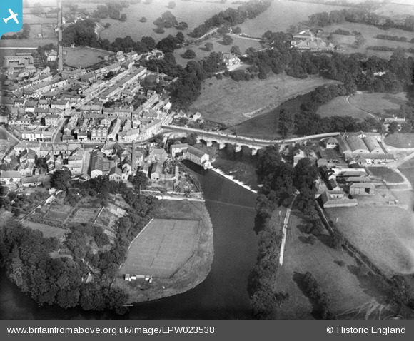
EPW023538 ENGLAND (1928). Wetherby Bridge, Micklethwaite Farm and the town, Wetherby, 1928
© Copyright OpenStreetMap contributors and licensed by the OpenStreetMap Foundation. 2026. Cartography is licensed as CC BY-SA.
Nearby Images (7)
EPW023538

EPW024345

EPW024346

EPW024341

EPW023536

EPW023539

EPW024340

Details
| Title | [EPW023538] Wetherby Bridge, Micklethwaite Farm and the town, Wetherby, 1928 |
| Reference | EPW023538 |
| Date | September-1928 |
| Link | |
| Place name | WETHERBY |
| Parish | WETHERBY |
| District | |
| Country | ENGLAND |
| Easting / Northing | 440366, 448017 |
| Longitude / Latitude | -1.3852102662805, 53.92651016254 |
| National Grid Reference | SE404480 |
Pins

MB |
Sunday 4th of November 2012 10:54:10 PM | |
|
MB |
Sunday 4th of November 2012 10:51:06 PM | |
|
MB |
Sunday 4th of November 2012 10:48:24 PM | |
|
MB |
Sunday 4th of November 2012 10:42:27 PM | |
|
MB |
Sunday 4th of November 2012 10:39:16 PM | |
|
MB |
Sunday 4th of November 2012 10:35:44 PM | |
The camp was part of a dry-land ship, HMS Ceres built in the early 1940s for the training of, mainly, writers. The part of the camp off Hallfield Lane was occupied by WRNS personnel and the main Headquarters in York Road was ultimately converted to a Borstal and then a Prison |
p.telford |
Saturday 19th of July 2014 10:35:00 AM |
|
MB |
Sunday 4th of November 2012 10:31:52 PM | |
|
MB |
Sunday 4th of November 2012 10:26:02 PM | |
|
MB |
Sunday 4th of November 2012 10:25:28 PM | |
|
MB |
Sunday 4th of November 2012 10:23:27 PM | |
|
MB |
Sunday 4th of November 2012 10:22:55 PM | |
|
MB |
Sunday 4th of November 2012 10:21:06 PM | |
|
MB |
Sunday 4th of November 2012 10:20:40 PM | |
|
MB |
Sunday 4th of November 2012 10:18:30 PM | |
|
MB |
Sunday 4th of November 2012 10:17:19 PM | |
The mill has since been demolished |
MB |
Sunday 4th of November 2012 10:43:43 PM |