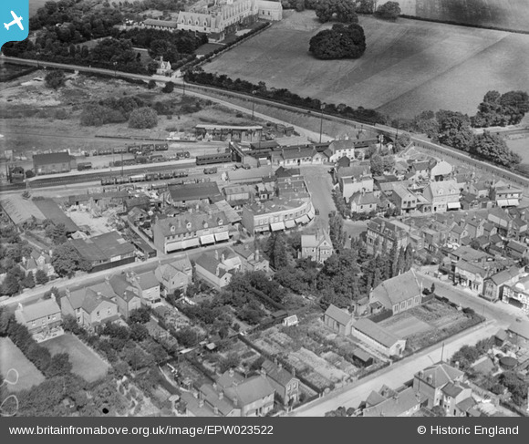
EPW023522 ENGLAND (1928). Station Road, the railway station and environs, Ashford, 1928
© Copyright OpenStreetMap contributors and licensed by the OpenStreetMap Foundation. 2026. Cartography is licensed as CC BY-SA.
Nearby Images (7)
Details
| Title | [EPW023522] Station Road, the railway station and environs, Ashford, 1928 |
| Reference | EPW023522 |
| Date | September-1928 |
| Link | |
| Place name | ASHFORD |
| Parish | |
| District | |
| Country | ENGLAND |
| Easting / Northing | 506558, 171880 |
| Longitude / Latitude | -0.46684266216745, 51.435394110618 |
| National Grid Reference | TQ066719 |
Pins

MB |
Friday 2nd of November 2012 05:42:30 PM | |

MB |
Friday 2nd of November 2012 05:34:28 PM | |

MB |
Friday 2nd of November 2012 05:33:53 PM | |

MB |
Friday 2nd of November 2012 05:32:09 PM | |

MB |
Friday 2nd of November 2012 05:30:00 PM | |

librarian |
Saturday 14th of July 2012 07:34:49 PM | |

librarian |
Saturday 14th of July 2012 07:33:05 PM |


![[EPW023522] Station Road, the railway station and environs, Ashford, 1928](http://britainfromabove.org.uk/sites/all/libraries/aerofilms-images/public/100x100/EPW/023/EPW023522.jpg)
![[EPW023518] Ashford Railway Station and environs, Ashford, 1928](http://britainfromabove.org.uk/sites/all/libraries/aerofilms-images/public/100x100/EPW/023/EPW023518.jpg)
![[EPW028355] Woodthorpe Road and the railway station, Ashford, 1929](http://britainfromabove.org.uk/sites/all/libraries/aerofilms-images/public/100x100/EPW/028/EPW028355.jpg)
![[EPW023517] Residential area around Chaucer Road, Ashford, 1928](http://britainfromabove.org.uk/sites/all/libraries/aerofilms-images/public/100x100/EPW/023/EPW023517.jpg)
![[EPW023520] Dudley Road and environs, Ashford, 1928](http://britainfromabove.org.uk/sites/all/libraries/aerofilms-images/public/100x100/EPW/023/EPW023520.jpg)
![[EPW028357] St Hilda's Church and Woodthorpe Road, Ashford, 1929](http://britainfromabove.org.uk/sites/all/libraries/aerofilms-images/public/100x100/EPW/028/EPW028357.jpg)
![[EPW028356] Church Road, Ashford, 1929](http://britainfromabove.org.uk/sites/all/libraries/aerofilms-images/public/100x100/EPW/028/EPW028356.jpg)