
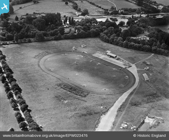
EPW023476 ENGLAND (1928). Staines Greyhound Track, Hythe End, 1928
© Copyright OpenStreetMap contributors and licensed by the OpenStreetMap Foundation. 2026. Cartography is licensed as CC BY-SA.
Nearby Images (2)
EPW023476

EPW023479

Details
| Title | [EPW023476] Staines Greyhound Track, Hythe End, 1928 |
| Reference | EPW023476 |
| Date | September-1928 |
| Link | |
| Place name | HYTHE END |
| Parish | WRAYSBURY |
| District | |
| Country | ENGLAND |
| Easting / Northing | 502070, 172190 |
| Longitude / Latitude | -0.5313033493813, 51.439007452154 |
| National Grid Reference | TQ021722 |
Pins
User Comment Contributions

Staines Speedway http://www.speedway-forum.co.uk/forums/index.php?showtopic=3297 |

BruceR |
Friday 21st of December 2012 09:18:31 PM |