
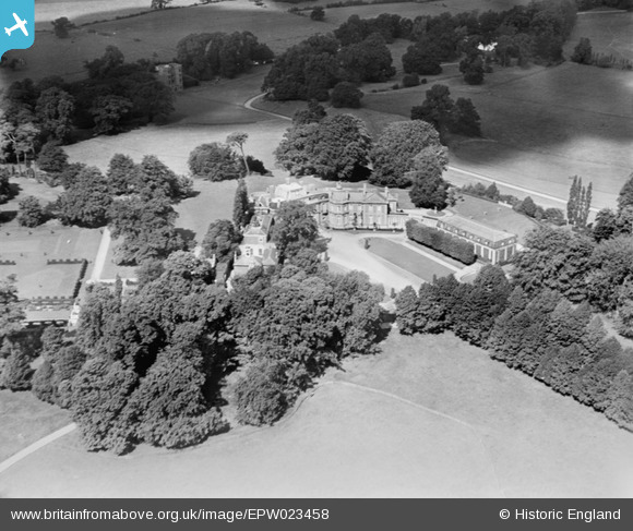
EPW023458 ENGLAND (1928). Esher Place and Wainfleet's Tower, Esher, 1928
© Copyright OpenStreetMap contributors and licensed by the OpenStreetMap Foundation. 2026. Cartography is licensed as CC BY-SA.
Nearby Images (4)
EPW023458

EPW021903

EPW023454

EPW021911

Details
| Title | [EPW023458] Esher Place and Wainfleet's Tower, Esher, 1928 |
| Reference | EPW023458 |
| Date | September-1928 |
| Link | |
| Place name | ESHER |
| Parish | |
| District | |
| Country | ENGLAND |
| Easting / Northing | 513399, 164895 |
| Longitude / Latitude | -0.37068907498312, 51.371277607086 |
| National Grid Reference | TQ134649 |
Pins
Be the first to add a comment to this image!