
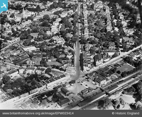
EPW023414 ENGLAND (1928). Station Approach and Claremont Road, Surbiton, 1928. This image has been produced from a copy-negative.
© Copyright OpenStreetMap contributors and licensed by the OpenStreetMap Foundation. 2026. Cartography is licensed as CC BY-SA.
Nearby Images (2)
EPW023414

EPW023413

Details
| Title | [EPW023414] Station Approach and Claremont Road, Surbiton, 1928. This image has been produced from a copy-negative. |
| Reference | EPW023414 |
| Date | September-1928 |
| Link | |
| Place name | SURBITON |
| Parish | |
| District | |
| Country | ENGLAND |
| Easting / Northing | 518052, 167454 |
| Longitude / Latitude | -0.30301518025145, 51.393331329839 |
| National Grid Reference | TQ181675 |
Pins

Leslie B |
Sunday 17th of July 2022 04:34:22 PM | |
|
John Wass |
Tuesday 14th of July 2020 07:48:26 PM | |
|
John Wass |
Saturday 8th of November 2014 03:00:32 PM |