
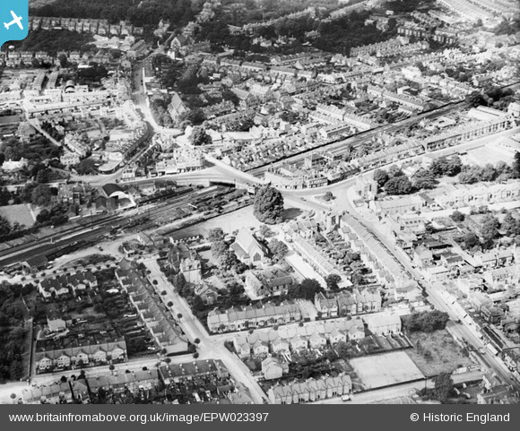
EPW023397 ENGLAND (1928). High Street and Broad Street, Teddington, 1928
© Copyright OpenStreetMap contributors and licensed by the OpenStreetMap Foundation. 2026. Cartography is licensed as CC BY-SA.
Nearby Images (4)
EPW023397

EPW023399

EPW023402

EPW023405

Details
| Title | [EPW023397] High Street and Broad Street, Teddington, 1928 |
| Reference | EPW023397 |
| Date | September-1928 |
| Link | |
| Place name | TEDDINGTON |
| Parish | |
| District | |
| Country | ENGLAND |
| Easting / Northing | 515926, 171039 |
| Longitude / Latitude | -0.33239000543512, 51.425994755821 |
| National Grid Reference | TQ159710 |
Pins

J M H |
Saturday 30th of April 2016 09:15:10 PM | |
|
J M H |
Saturday 30th of April 2016 09:13:20 PM | |
|
J M H |
Saturday 30th of April 2016 09:11:37 PM | |
|
J M H |
Saturday 30th of April 2016 09:10:23 PM | |
|
Pip |
Friday 3rd of January 2014 02:01:46 AM | |
|
ColinM |
Tuesday 30th of April 2013 09:55:24 PM | |
|
ColinM |
Tuesday 30th of April 2013 09:54:33 PM | |
|
ColinM |
Tuesday 30th of April 2013 09:54:06 PM | |
|
ColinM |
Tuesday 30th of April 2013 09:53:47 PM |