
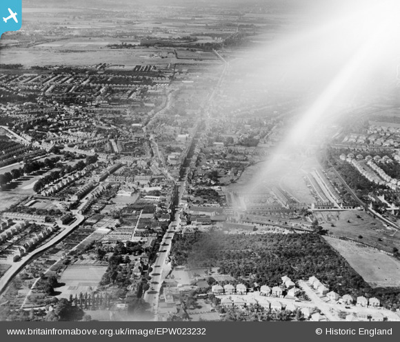
EPW023232 ENGLAND (1928). High Street and surroundings, Housnlow, from the north-east, 1928. This image has been affected by flare.
© Copyright OpenStreetMap contributors and licensed by the OpenStreetMap Foundation. 2026. Cartography is licensed as CC BY-SA.
Nearby Images (3)
EPW023232

EPW031668

EPW035090

Details
| Title | [EPW023232] High Street and surroundings, Housnlow, from the north-east, 1928. This image has been affected by flare. |
| Reference | EPW023232 |
| Date | September-1928 |
| Link | |
| Place name | HOUNSLOW |
| Parish | |
| District | |
| Country | ENGLAND |
| Easting / Northing | 514418, 175983 |
| Longitude / Latitude | -0.35247402929099, 51.470742246425 |
| National Grid Reference | TQ144760 |
Pins

Leslie B |
Saturday 5th of March 2016 08:03:29 AM | |
|
Ellieann |
Monday 27th of August 2012 01:53:28 PM | |
 |
Ellieann |
Monday 27th of August 2012 01:50:32 PM |
|
Ellieann |
Monday 27th of August 2012 01:41:44 PM | |
|
Isleworth1961 |
Friday 13th of July 2012 10:57:28 PM | |
|
Isleworth1961 |
Friday 13th of July 2012 10:56:04 PM |