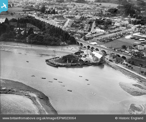
EPW023064 ENGLAND (1928). Upper Quay and Viaduct, Fareham, 1928
© Copyright OpenStreetMap contributors and licensed by the OpenStreetMap Foundation. 2026. Cartography is licensed as CC BY-SA.
Nearby Images (3)
EPW023064

EPW023074

EPW023068

Details
| Title | [EPW023064] Upper Quay and Viaduct, Fareham, 1928 |
| Reference | EPW023064 |
| Date | August-1928 |
| Link | |
| Place name | FAREHAM |
| Parish | |
| District | |
| Country | ENGLAND |
| Easting / Northing | 458034, 105900 |
| Longitude / Latitude | -1.1755322426265, 50.849146130147 |
| National Grid Reference | SU580059 |
Pins

Vicar |
Thursday 29th of November 2018 12:42:19 PM | |
|
Vicar |
Thursday 29th of November 2018 12:40:10 PM | |
|
Vicar |
Thursday 29th of November 2018 12:39:19 PM | |
|
Vicar |
Thursday 29th of November 2018 12:38:28 PM | |
|
Vicar |
Thursday 29th of November 2018 12:36:49 PM | |
|
kevtees |
Wednesday 26th of February 2014 02:01:08 PM | |
|
MB |
Monday 29th of October 2012 02:51:10 PM | |
|
patsmithuk |
Monday 27th of August 2012 04:18:46 PM | |
|
patsmithuk |
Monday 27th of August 2012 04:17:17 PM |