
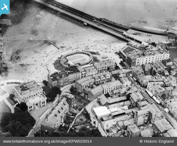
EPW023014 ENGLAND (1928). The Bandstand and Western Gardens, Ryde, 1928
© Copyright OpenStreetMap contributors and licensed by the OpenStreetMap Foundation. 2026. Cartography is licensed as CC BY-SA.
Nearby Images (6)
EPW023014

EAW025839

EPW023006

EPW000785

EPW023008

EPW000791

Details
| Title | [EPW023014] The Bandstand and Western Gardens, Ryde, 1928 |
| Reference | EPW023014 |
| Date | August-1928 |
| Link | |
| Place name | RYDE |
| Parish | RYDE |
| District | |
| Country | ENGLAND |
| Easting / Northing | 459271, 92930 |
| Longitude / Latitude | -1.1600535674217, 50.73238625661 |
| National Grid Reference | SZ593929 |
Pins

flubber |
Tuesday 20th of November 2012 10:05:35 PM |