
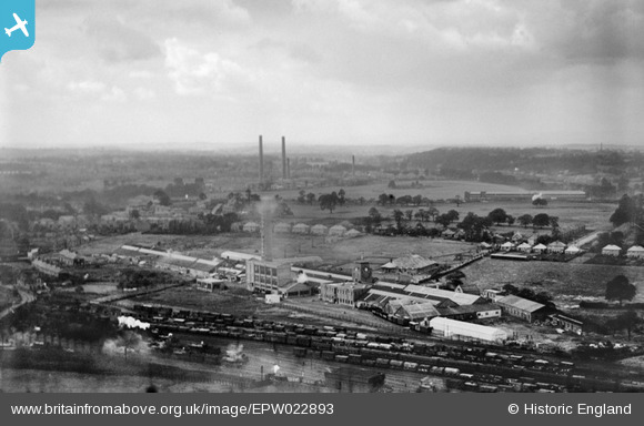
EPW022893 ENGLAND (1928). Goodyear Tyre and Rubber Works, Bushbury, from the north-west, 1928
© Copyright OpenStreetMap contributors and licensed by the OpenStreetMap Foundation. 2026. Cartography is licensed as CC BY-SA.
Nearby Images (24)
EPW022893

EPW022888

EPW022891

EPW054854

EPW054853

EPW054855

EPW028633

EPW028635

EPW045789

EAW000787

EPW054856

EPW024555

EPW045787

EPW020000

EPW045792

EPW028631

EPW024554

EPW024552

EPW022892

EPW045790

EPW045786

EAW000788

EAW000790

EPW020006

Details
| Title | [EPW022893] Goodyear Tyre and Rubber Works, Bushbury, from the north-west, 1928 |
| Reference | EPW022893 |
| Date | August-1928 |
| Link | |
| Place name | BUSHBURY |
| Parish | |
| District | |
| Country | ENGLAND |
| Easting / Northing | 391609, 301616 |
| Longitude / Latitude | -2.1239364376933, 52.611901619003 |
| National Grid Reference | SJ916016 |
Pins
Be the first to add a comment to this image!