
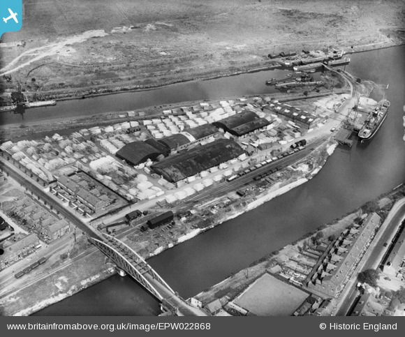
EPW022868 ENGLAND (1928). Naylors Timber Yard and the Chester Road Swing Bridge, Warrington, 1928
© Copyright OpenStreetMap contributors and licensed by the OpenStreetMap Foundation. 2026. Cartography is licensed as CC BY-SA.
Nearby Images (2)
EPW022868

EPW022869

Details
| Title | [EPW022868] Naylors Timber Yard and the Chester Road Swing Bridge, Warrington, 1928 |
| Reference | EPW022868 |
| Date | August-1928 |
| Link | |
| Place name | WARRINGTON |
| Parish | |
| District | |
| Country | ENGLAND |
| Easting / Northing | 360510, 386251 |
| Longitude / Latitude | -2.5935994168446, 53.371378690877 |
| National Grid Reference | SJ605863 |
Pins
Be the first to add a comment to this image!
User Comment Contributions

Visit this for a good view of the Manchester Ship Canal |

Frank S |
Saturday 30th of June 2012 11:11:17 AM |