
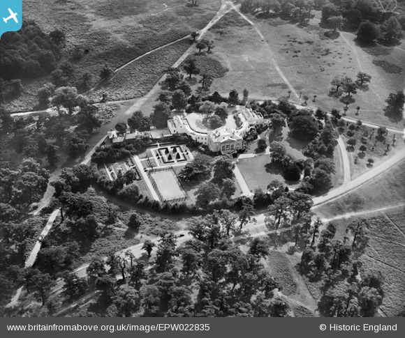
EPW022835 ENGLAND (1928). White Lodge, Richmond Park, 1928
© Copyright OpenStreetMap contributors and licensed by the OpenStreetMap Foundation. 2026. Cartography is licensed as CC BY-SA.
Nearby Images (6)
EPW022835

EPW022832

EAW014191

EAW014193

EAW014190

EAW014192

Details
| Title | [EPW022835] White Lodge, Richmond Park, 1928 |
| Reference | EPW022835 |
| Date | August-1928 |
| Link | |
| Place name | RICHMOND PARK |
| Parish | |
| District | |
| Country | ENGLAND |
| Easting / Northing | 520676, 173255 |
| Longitude / Latitude | -0.26333837091175, 51.444921501143 |
| National Grid Reference | TQ207733 |
Pins
Be the first to add a comment to this image!