
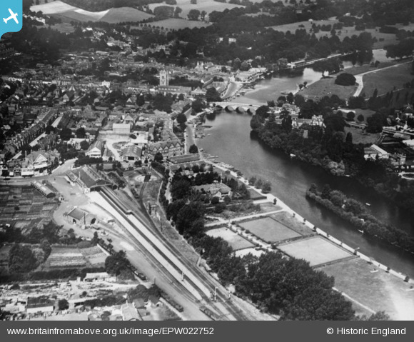
EPW022752 ENGLAND (1928). The town, Henley-on-Thames, 1928. This image has been produced from a copy-negative.
© Copyright OpenStreetMap contributors and licensed by the OpenStreetMap Foundation. 2026. Cartography is licensed as CC BY-SA.
Nearby Images (5)
EPW022752

EPW022753

EPW000859

EAW044518

EPW000855

Details
| Title | [EPW022752] The town, Henley-on-Thames, 1928. This image has been produced from a copy-negative. |
| Reference | EPW022752 |
| Date | August-1928 |
| Link | |
| Place name | HENLEY-ON-THAMES |
| Parish | HENLEY-ON-THAMES |
| District | |
| Country | ENGLAND |
| Easting / Northing | 476411, 182412 |
| Longitude / Latitude | -0.8982150040542, 51.534955638779 |
| National Grid Reference | SU764824 |
