
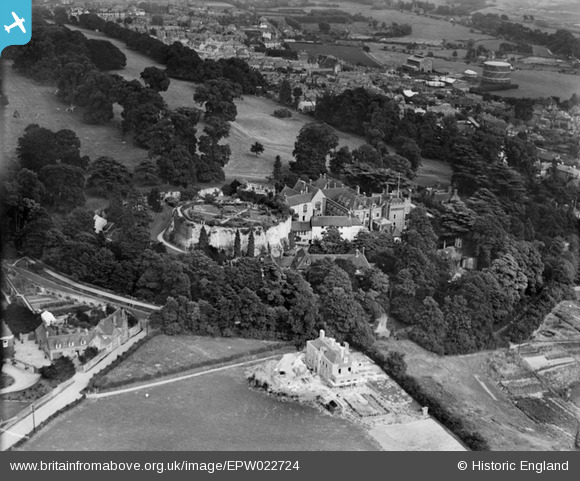
EPW022724 ENGLAND (1928). Farnham Castle, Farnham, 1928
© Copyright OpenStreetMap contributors and licensed by the OpenStreetMap Foundation. 2026. Cartography is licensed as CC BY-SA.
Nearby Images (19)
EPW022724

EAW015546

EPW056809

EAW005206

EPW032701

EAW005204

EPW022825

EAW005205

EAW049367

EAW049364

EAW005203

EAW015544

EAW049363

EAW049362

EAW015545

EAW049368

EAW049365

EAW049366

EAW049369

Details
| Title | [EPW022724] Farnham Castle, Farnham, 1928 |
| Reference | EPW022724 |
| Date | August-1928 |
| Link | |
| Place name | FARNHAM |
| Parish | FARNHAM |
| District | |
| Country | ENGLAND |
| Easting / Northing | 483722, 147307 |
| Longitude / Latitude | -0.80109444354387, 51.218299496127 |
| National Grid Reference | SU837473 |
Pins

MB |
Sunday 21st of October 2012 10:31:43 AM | |
|
MB |
Sunday 21st of October 2012 10:30:14 AM | |
|
MB |
Sunday 21st of October 2012 10:28:24 AM | |
|
MB |
Sunday 21st of October 2012 10:27:57 AM | |
|
MB |
Sunday 21st of October 2012 10:24:53 AM | |
|
flubber |
Wednesday 11th of July 2012 06:44:03 PM | |
|
flubber |
Wednesday 11th of July 2012 06:42:51 PM | |
Corner property is The Grange built by a Mr Forbes around 1710 on land formerly part of the Bishop of Winchester's land. |
John Wainwright |
Friday 28th of December 2012 03:25:27 PM |
User Comment Contributions
The castle was built in 1138-1140 by Henry de Blois, Bishop of Winchester and brother of King Stephen and grandson of William the Conqueror. The massive keep has an internal diameter of 175 feet. It is actually polygonal externally with buttresses at each angle. The buildings in the bailey included a great hall, a kitchen and a chapel. Housing was remodelled in the seventeenth century. This was the location for the UK's military camouflage centre in World War II. Restoration work on the keep ewas completed in 2010 |
MB |
Sunday 21st of October 2012 10:40:55 AM |