
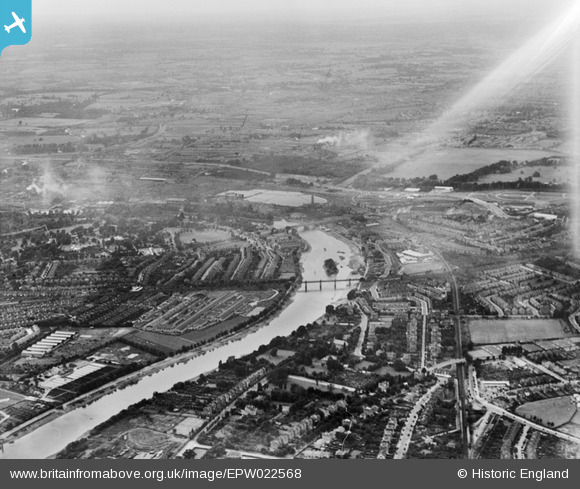
EPW022568 ENGLAND (1928). The River Thames at Kew and Brentford, Kew, from the south-east, 1928
© Copyright OpenStreetMap contributors and licensed by the OpenStreetMap Foundation. 2026. Cartography is licensed as CC BY-SA.
Nearby Images (4)
EPW022568

EPW055293

EPW062038
, Kew Railway Bridge and Strand on the Green, Kew, from the south, 1939")
EPW042214
 and environs, Duke's Meadows, 1933")
Details
| Title | [EPW022568] The River Thames at Kew and Brentford, Kew, from the south-east, 1928 |
| Reference | EPW022568 |
| Date | 7-August-1928 |
| Link | |
| Place name | KEW |
| Parish | |
| District | |
| Country | ENGLAND |
| Easting / Northing | 519762, 177237 |
| Longitude / Latitude | -0.27513624194772, 51.480907716195 |
| National Grid Reference | TQ198772 |
Pins

Martin Devlin |
Wednesday 26th of January 2022 11:31:32 AM | |
|
Martin Devlin |
Wednesday 26th of January 2022 11:26:12 AM | |
|
Mark Amies |
Wednesday 8th of January 2020 01:34:35 PM | |
|
Daf |
Wednesday 6th of March 2013 02:46:28 PM | |
|
Daf |
Wednesday 6th of March 2013 02:43:57 PM | |
|
Daf |
Wednesday 6th of March 2013 02:43:00 PM | |
|
librarian |
Tuesday 11th of December 2012 04:24:19 PM | |
|
SteveP |
Thursday 16th of August 2012 08:42:24 AM | |
|
SteveP |
Thursday 16th of August 2012 08:41:26 AM |