
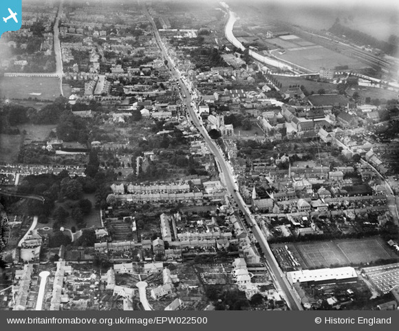
EPW022500 ENGLAND (1928). St Peter's Church and the High Street, Berkhamsted, from the south-east, 1928
© Copyright OpenStreetMap contributors and licensed by the OpenStreetMap Foundation. 2026. Cartography is licensed as CC BY-SA.
Nearby Images (9)
EPW022500

EPW056454

EPW056457

EPW056452

EPW005035

EPW005032

EPW005037

EPW022496

EPW056456

Details
| Title | [EPW022500] St Peter's Church and the High Street, Berkhamsted, from the south-east, 1928 |
| Reference | EPW022500 |
| Date | August-1928 |
| Link | |
| Place name | BERKHAMSTED |
| Parish | BERKHAMSTED |
| District | |
| Country | ENGLAND |
| Easting / Northing | 499552, 207585 |
| Longitude / Latitude | -0.55747522753314, 51.757639839297 |
| National Grid Reference | SP996076 |
Pins

D Figueiredo |
Wednesday 19th of December 2012 10:17:06 AM | |
|
D Figueiredo |
Wednesday 19th of December 2012 10:16:10 AM | |
|
Vonderene |
Sunday 1st of July 2012 05:43:03 PM |