
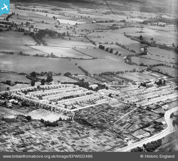
EPW022486 ENGLAND (1928). The village and allotments, New Bradwell, 1928
© Copyright OpenStreetMap contributors and licensed by the OpenStreetMap Foundation. 2026. Cartography is licensed as CC BY-SA.
Details
| Title | [EPW022486] The village and allotments, New Bradwell, 1928 |
| Reference | EPW022486 |
| Date | 9-August-1928 |
| Link | |
| Place name | NEW BRADWELL |
| Parish | NEW BRADWELL |
| District | |
| Country | ENGLAND |
| Easting / Northing | 482849, 241644 |
| Longitude / Latitude | -0.79124686399085, 52.066546953816 |
| National Grid Reference | SP828416 |
Pins

Class31 |
Monday 29th of October 2012 12:45:12 PM | |
|
Class31 |
Monday 29th of October 2012 12:44:17 PM | |
|
Class31 |
Monday 29th of October 2012 12:41:32 PM | |
|
Class31 |
Monday 29th of October 2012 12:40:21 PM | |
|
Class31 |
Monday 29th of October 2012 12:40:03 PM | |
|
Class31 |
Monday 29th of October 2012 12:39:40 PM | |
|
Class31 |
Monday 29th of October 2012 12:39:23 PM | |
|
Class31 |
Monday 29th of October 2012 12:38:50 PM | |
|
Class31 |
Monday 29th of October 2012 12:38:03 PM |
User Comment Contributions
New Bradwell is now part of Milton Keynes |

OldGreyBeard |
Friday 3rd of May 2013 07:11:36 PM |