
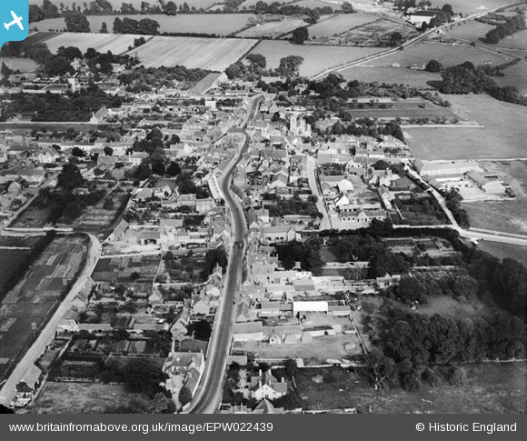
EPW022439 ENGLAND (1928). Acre End Street and environs, Eynsham, from the west, 1928
© Copyright OpenStreetMap contributors and licensed by the OpenStreetMap Foundation. 2026. Cartography is licensed as CC BY-SA.
Nearby Images (3)
EPW022439

EPW022446

EPW022445

Details
| Title | [EPW022439] Acre End Street and environs, Eynsham, from the west, 1928 |
| Reference | EPW022439 |
| Date | August-1928 |
| Link | |
| Place name | EYNSHAM |
| Parish | EYNSHAM |
| District | |
| Country | ENGLAND |
| Easting / Northing | 442980, 209267 |
| Longitude / Latitude | -1.3769179091107, 51.779964942547 |
| National Grid Reference | SP430093 |
Pins
Be the first to add a comment to this image!