
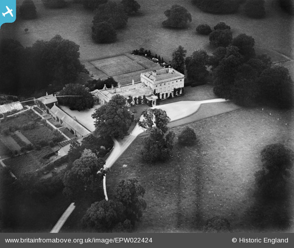
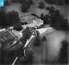
EPW022424 ENGLAND (1928). Fairford Park, Fairford, 1928
© Copyright OpenStreetMap contributors and licensed by the OpenStreetMap Foundation. 2026. Cartography is licensed as CC BY-SA.
Details
| Title | [EPW022424] Fairford Park, Fairford, 1928 |
| Reference | EPW022424 |
| Date | 11-August-1928 |
| Link | |
| Place name | FAIRFORD |
| Parish | FAIRFORD |
| District | |
| Country | ENGLAND |
| Easting / Northing | 415281, 201777 |
| Longitude / Latitude | -1.7787940166445, 51.714056722761 |
| National Grid Reference | SP153018 |
Pins
Be the first to add a comment to this image!
User Comment Contributions
During the Second World War, the 17th-century Fairford Park House was used as an American military hospital, and until 1959 Polish refugees were housed in a camp in the park. The house was demolished in the 1950s, and its site is now occupied by Farmor's Comprehensive School. |

James Chandler |
Sunday 23rd of March 2014 01:15:05 PM |
Fairford Park |
Hefin Meara |
Tuesday 22nd of January 2013 11:31:25 AM |