
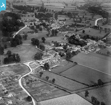
EPW022421 ENGLAND (1928). Milton End and Fairford, Milton End, from the north-west, 1928

© Copyright OpenStreetMap contributors and licensed by the OpenStreetMap Foundation. 2026. Cartography is licensed as CC BY-SA.
Details
| Title | [EPW022421] Milton End and Fairford, Milton End, from the north-west, 1928 |
| Reference | EPW022421 |
| Date | August-1928 |
| Link | |
| Place name | MILTON END |
| Parish | FAIRFORD |
| District | |
| Country | ENGLAND |
| Easting / Northing | 414461, 201205 |
| Longitude / Latitude | -1.7906878961979, 51.708934974358 |
| National Grid Reference | SP145012 |
Pins

S J Hersom |
Saturday 27th of June 2020 09:37:10 PM |
User Comment Contributions
View from the north west |
Hefin Meara |
Tuesday 22nd of January 2013 11:33:19 AM |