
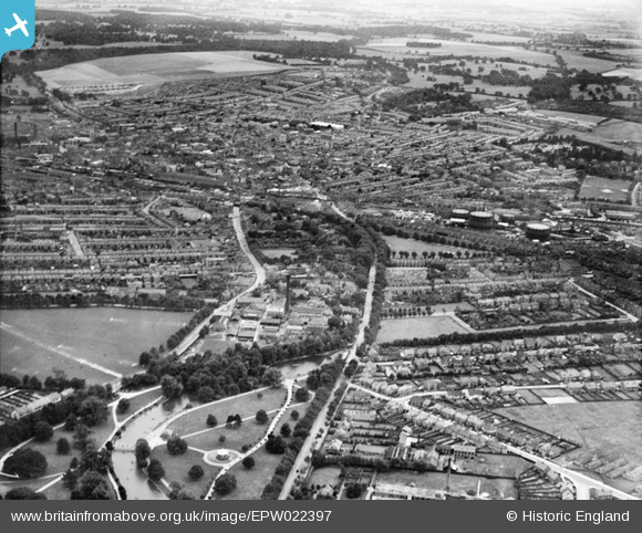
EPW022397 ENGLAND (1928). The town, Luton, from the north, 1928
© Copyright OpenStreetMap contributors and licensed by the OpenStreetMap Foundation. 2026. Cartography is licensed as CC BY-SA.
Nearby Images (2)
EPW022397

EPW026487

Details
| Title | [EPW022397] The town, Luton, from the north, 1928 |
| Reference | EPW022397 |
| Date | 9-August-1928 |
| Link | |
| Place name | LUTON |
| Parish | |
| District | |
| Country | ENGLAND |
| Easting / Northing | 508801, 222402 |
| Longitude / Latitude | -0.41885138426212, 51.889103155368 |
| National Grid Reference | TL088224 |
Pins

Dennis Jackson |
Sunday 10th of March 2013 12:57:01 AM | |

Dylan Moore |
Saturday 27th of October 2012 04:52:30 PM | |
|
Dylan Moore |
Saturday 27th of October 2012 04:51:38 PM | |
|
Dylan Moore |
Saturday 27th of October 2012 04:50:17 PM | |
|
Dylan Moore |
Saturday 27th of October 2012 04:49:56 PM | |
|
Dylan Moore |
Saturday 27th of October 2012 04:49:29 PM | |
|
Dylan Moore |
Thursday 25th of October 2012 10:37:19 PM | |
|
Dylan Moore |
Thursday 25th of October 2012 10:37:02 PM | |
|
Dylan Moore |
Thursday 25th of October 2012 10:35:43 PM |