
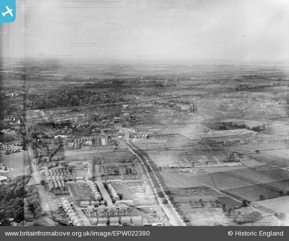
EPW022380 ENGLAND (1928). The London Road and environs, Bedford, from the south-east, 1928. Double-exposed negative.
© Copyright OpenStreetMap contributors and licensed by the OpenStreetMap Foundation. 2026. Cartography is licensed as CC BY-SA.
Nearby Images (2)
EPW022380

EAW003722

Details
| Title | [EPW022380] The London Road and environs, Bedford, from the south-east, 1928. Double-exposed negative. |
| Reference | EPW022380 |
| Date | 9-August-1928 |
| Link | |
| Place name | BEDFORD |
| Parish | |
| District | |
| Country | ENGLAND |
| Easting / Northing | 505667, 248538 |
| Longitude / Latitude | -0.4563146420886, 52.124629083309 |
| National Grid Reference | TL057485 |
Pins

Bwlvych |
Thursday 11th of September 2014 02:28:01 PM |
User Comment Contributions
Real shame about the D.E. Maybe some advanced software could be used on the original negatives at some point in the future. |

Jet |
Thursday 12th of February 2015 10:34:37 PM |
Looks like a double exposure to me? |
Bwlvych |
Thursday 11th of September 2014 03:03:37 PM |
Hi Bwlvych, we think so too, although it's not as obvious as some double-exposures. There are a few corkers in the Aerofilms Collection! But fortunately not too many. We mention it in the caption, and we have a cataloguing rule about them to help us create a suitable record. Yours, Katy Britain from Above Cataloguing Team Leader |
Katy Whitaker |
Thursday 11th of September 2014 03:03:37 PM |