
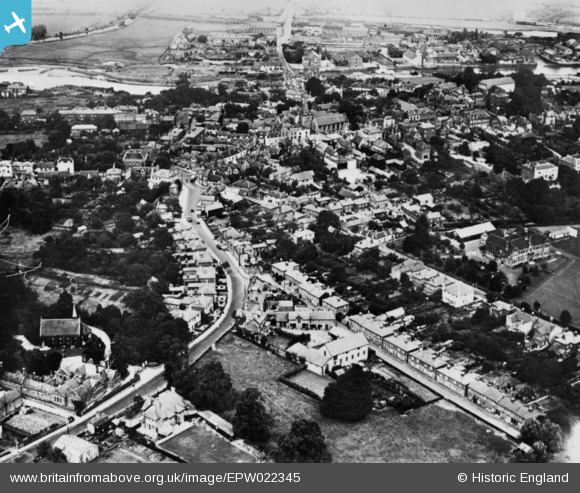
EPW022345 ENGLAND (1928). The town, Maldon, 1928. This image has been produced from a copy-negative.
© Copyright OpenStreetMap contributors and licensed by the OpenStreetMap Foundation. 2026. Cartography is licensed as CC BY-SA.
Nearby Images (6)
EPW022345

EPW054677

EAW001529

EPW054685

EAW001528

EAW021831

Details
| Title | [EPW022345] The town, Maldon, 1928. This image has been produced from a copy-negative. |
| Reference | EPW022345 |
| Date | August-1928 |
| Link | |
| Place name | MALDON |
| Parish | MALDON |
| District | |
| Country | ENGLAND |
| Easting / Northing | 584805, 206896 |
| Longitude / Latitude | 0.67637023466332, 51.729814348728 |
| National Grid Reference | TL848069 |
Pins

Stu Giles |
Friday 6th of July 2018 04:37:18 PM | |

Class31 |
Wednesday 7th of January 2015 04:41:42 PM | |
|
Class31 |
Wednesday 7th of January 2015 04:40:19 PM |

