
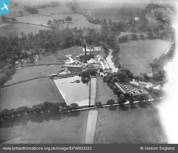
EPW022222 ENGLAND (1928). The Chadkirk Works, Chadkirk, 1928
© Copyright OpenStreetMap contributors and licensed by the OpenStreetMap Foundation. 2026. Cartography is licensed as CC BY-SA.
Nearby Images (16)
EPW022222

EPW022224

EPW022220

EPW022219

EPW022223

EPW022880

EPW022221

EPW022227

EPW024185

EPW022226

EPW022881

EPW023824

EPW022225

EPW022879

EPW023825

EPW023833

Details
| Title | [EPW022222] The Chadkirk Works, Chadkirk, 1928 |
| Reference | EPW022222 |
| Date | 31-July-1928 |
| Link | |
| Place name | CHADKIRK |
| Parish | |
| District | |
| Country | ENGLAND |
| Easting / Northing | 393830, 389569 |
| Longitude / Latitude | -2.0928127267174, 53.402646038711 |
| National Grid Reference | SJ938896 |
Pins

buryblackpud |
Friday 16th of February 2024 04:00:29 PM | |
|
buryblackpud |
Friday 16th of February 2024 03:59:06 PM | |

Class31 |
Saturday 4th of August 2012 07:03:58 AM | |
|
Class31 |
Saturday 4th of August 2012 07:02:51 AM | |
|
Class31 |
Saturday 4th of August 2012 07:02:25 AM | |
|
Class31 |
Saturday 4th of August 2012 06:55:33 AM |