
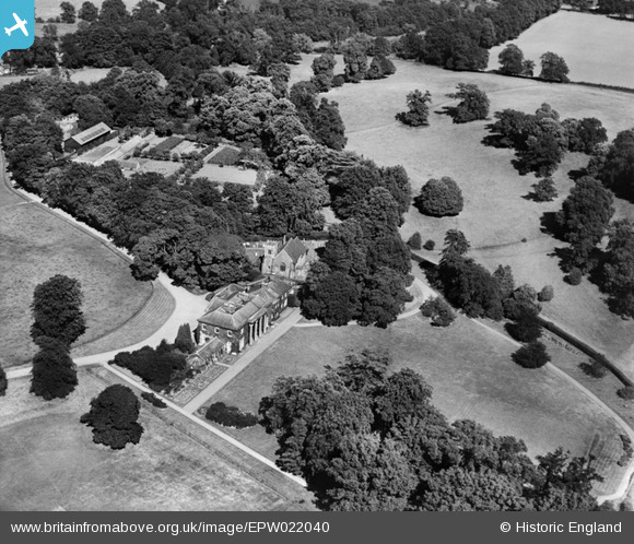
EPW022040 ENGLAND (1928). Digswell House and St John's Church, Digswell Park, 1928
© Copyright OpenStreetMap contributors and licensed by the OpenStreetMap Foundation. 2026. Cartography is licensed as CC BY-SA.
Nearby Images (3)
EPW022040

EPW022034

EPW022038

Details
| Title | [EPW022040] Digswell House and St John's Church, Digswell Park, 1928 |
| Reference | EPW022040 |
| Date | July-1928 |
| Link | |
| Place name | DIGSWELL PARK |
| Parish | |
| District | |
| Country | ENGLAND |
| Easting / Northing | 523814, 214849 |
| Longitude / Latitude | -0.20349022056108, 51.818087492067 |
| National Grid Reference | TL238148 |
Pins
Be the first to add a comment to this image!